
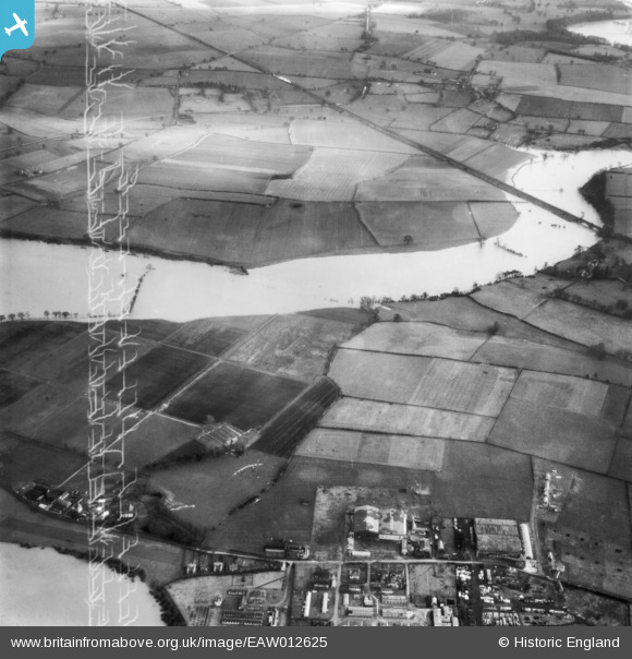
EAW012625 ENGLAND (1948). The River Severn in flood at Monkmoor, Shrewsbury, 1948. This image has been produced from a damaged negative.
© Copyright OpenStreetMap contributors and licensed by the OpenStreetMap Foundation. 2026. Cartography is licensed as CC BY-SA.
Nearby Images (2)
EAW012625

EAW012529

Details
| Title | [EAW012625] The River Severn in flood at Monkmoor, Shrewsbury, 1948. This image has been produced from a damaged negative. |
| Reference | EAW012625 |
| Date | 14-January-1948 |
| Link | |
| Place name | SHREWSBURY |
| Parish | SHREWSBURY |
| District | |
| Country | ENGLAND |
| Easting / Northing | 352041, 313323 |
| Longitude / Latitude | -2.7100372933863, 52.715095136436 |
| National Grid Reference | SJ520133 |
Pins

Matt Aldred edob.mattaldred.com |
Saturday 27th of February 2021 05:45:42 PM | |
|
Matt Aldred edob.mattaldred.com |
Saturday 27th of February 2021 05:28:37 PM |