
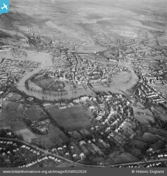
EAW012616 ENGLAND (1948). The River Severn in flood, Shrewsbury, 1948
© Copyright OpenStreetMap contributors and licensed by the OpenStreetMap Foundation. 2026. Cartography is licensed as CC BY-SA.
Nearby Images (8)
EAW012616

EAW001628

EPW017978

EPW018045

EPW040081

EPW017972

EPW040080

EPW017975

Details
| Title | [EAW012616] The River Severn in flood, Shrewsbury, 1948 |
| Reference | EAW012616 |
| Date | 14-January-1948 |
| Link | |
| Place name | SHREWSBURY |
| Parish | SHREWSBURY |
| District | |
| Country | ENGLAND |
| Easting / Northing | 348850, 312274 |
| Longitude / Latitude | -2.7571127159771, 52.705372488258 |
| National Grid Reference | SJ489123 |
