
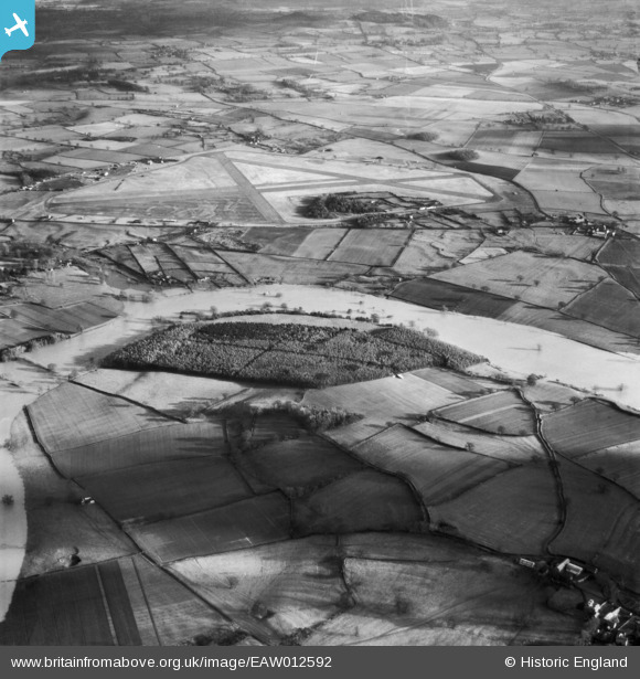
EAW012592 ENGLAND (1948). The River Severn in flood at Bickley Coppice, Bicton, 1948
© Copyright OpenStreetMap contributors and licensed by the OpenStreetMap Foundation. 2026. Cartography is licensed as CC BY-SA.
Nearby Images (5)
EAW012592

EAW012676

EAW012484

EAW012854

EAW012483

Details
| Title | [EAW012592] The River Severn in flood at Bickley Coppice, Bicton, 1948 |
| Reference | EAW012592 |
| Date | 14-January-1948 |
| Link | |
| Place name | BICTON |
| Parish | BICTON |
| District | |
| Country | ENGLAND |
| Easting / Northing | 344002, 316371 |
| Longitude / Latitude | -2.8295627047963, 52.741723380505 |
| National Grid Reference | SJ440164 |
Pins

Gerald |
Sunday 7th of June 2026 07:34:44 PM | |
|
Graham Yaxley |
Friday 30th of January 2015 11:03:15 PM | |
Yes Forton airfield, shame the negative has been printed from the reverse side. |
Gerald |
Sunday 7th of June 2026 09:33:40 PM |