
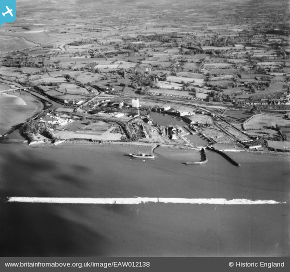
EAW012138 ENGLAND (1947). Sharpness Docks, Sharpness, 1947. This image was marked by Aerofilms Ltd for photo editing.
© Copyright OpenStreetMap contributors and licensed by the OpenStreetMap Foundation. 2026. Cartography is licensed as CC BY-SA.
Nearby Images (11)
EAW012138

EAW012141

EPW005401

EPW029346

EAW006849

EPW029343

EAW012140

EPW029344

EPW029349

EPW037753

EPW029348

Details
| Title | [EAW012138] Sharpness Docks, Sharpness, 1947. This image was marked by Aerofilms Ltd for photo editing. |
| Reference | EAW012138 |
| Date | 5-November-1947 |
| Link | |
| Place name | SHARPNESS |
| Parish | HINTON |
| District | |
| Country | ENGLAND |
| Easting / Northing | 366960, 202456 |
| Longitude / Latitude | -2.4783405574632, 51.719397069946 |
| National Grid Reference | SO670025 |
Pins

Matt Aldred edob.mattaldred.com |
Sunday 29th of November 2020 05:03:04 PM | |

J May |
Friday 15th of September 2017 12:48:20 PM | |
|
Al |
Sunday 8th of December 2013 09:07:40 PM | |
|
emu-star |
Thursday 28th of November 2013 08:00:51 PM |
User Comment Contributions

Pillbox, Sharpness. |
cptpies |
Thursday 19th of December 2013 02:03:17 PM |