
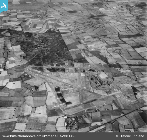
EAW011496 ENGLAND (1947). RAF Riccall Airfield, Riccall Common, 1947
© Copyright OpenStreetMap contributors and licensed by the OpenStreetMap Foundation. 2026. Cartography is licensed as CC BY-SA.
Nearby Images (2)
EAW011496

EAW011497

Details
| Title | [EAW011496] RAF Riccall Airfield, Riccall Common, 1947 |
| Reference | EAW011496 |
| Date | 24-September-1947 |
| Link | |
| Place name | RICCALL COMMON |
| Parish | RICCALL |
| District | |
| Country | ENGLAND |
| Easting / Northing | 464718, 436682 |
| Longitude / Latitude | -1.0167616870404, 53.822165146667 |
| National Grid Reference | SE647367 |
Pins
Be the first to add a comment to this image!
User Comment Contributions
All runways out of use. |

gBr |
Friday 3rd of March 2017 01:41:30 PM |