
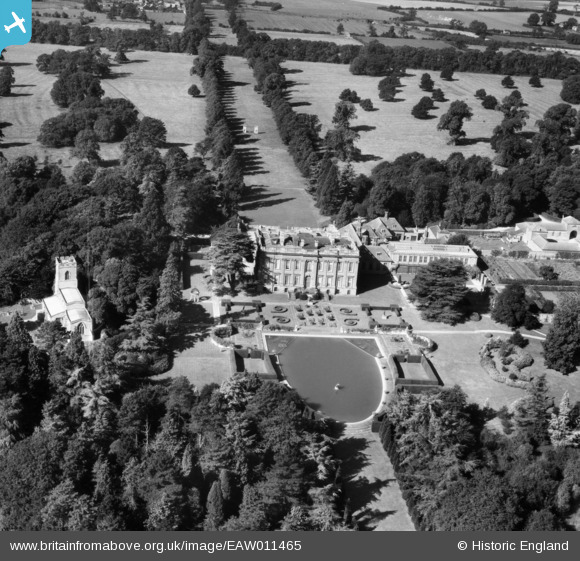
EAW011465 ENGLAND (1947). Easton Neston House and St Mary's Church, Easton Neston Park, 1947
© Copyright OpenStreetMap contributors and licensed by the OpenStreetMap Foundation. 2026. Cartography is licensed as CC BY-SA.
Nearby Images (6)
EAW011465

EPW023768

EPW023767

EAW011466

EPW023762

EAW011464

Details
| Title | [EAW011465] Easton Neston House and St Mary's Church, Easton Neston Park, 1947 |
| Reference | EAW011465 |
| Date | 24-September-1947 |
| Link | |
| Place name | EASTON NESTON PARK |
| Parish | EASTON NESTON |
| District | |
| Country | ENGLAND |
| Easting / Northing | 470196, 249257 |
| Longitude / Latitude | -0.97424814511236, 52.136737393829 |
| National Grid Reference | SP702493 |
Pins
Be the first to add a comment to this image!