
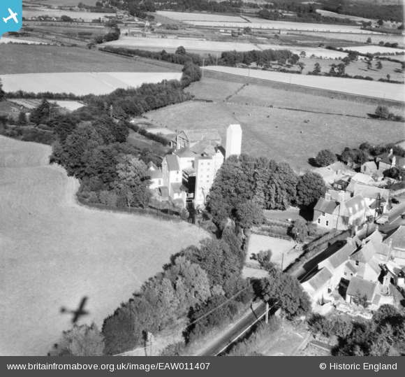
EAW011407 ENGLAND (1947). Horsebridge Flour Mill, Upper Horsebridge, 1947
© Copyright OpenStreetMap contributors and licensed by the OpenStreetMap Foundation. 2026. Cartography is licensed as CC BY-SA.
Nearby Images (8)
EAW011407

EAW011406

EAW011410

EAW011409

EAW011405

EAW011408

EAW011411

EAW011412

Details
| Title | [EAW011407] Horsebridge Flour Mill, Upper Horsebridge, 1947 |
| Reference | EAW011407 |
| Date | 1-October-1947 |
| Link | |
| Place name | UPPER HORSEBRIDGE |
| Parish | HAILSHAM |
| District | |
| Country | ENGLAND |
| Easting / Northing | 558104, 111316 |
| Longitude / Latitude | 0.24766777951429, 50.879124414269 |
| National Grid Reference | TQ581113 |
Pins
Be the first to add a comment to this image!