
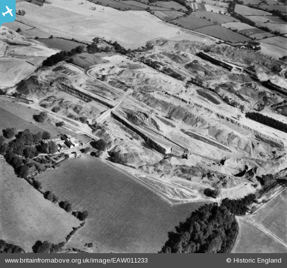
EAW011233 ENGLAND (1947). Opencast coal mining to the east of Flamstead Farm, Denby Village, 1947
© Copyright OpenStreetMap contributors and licensed by the OpenStreetMap Foundation. 2026. Cartography is licensed as CC BY-SA.
Nearby Images (3)
EAW011233

EAW011231

EAW017958

Details
| Title | [EAW011233] Opencast coal mining to the east of Flamstead Farm, Denby Village, 1947 |
| Reference | EAW011233 |
| Date | 30-September-1947 |
| Link | |
| Place name | DENBY VILLAGE |
| Parish | DENBY |
| District | |
| Country | ENGLAND |
| Easting / Northing | 440840, 346023 |
| Longitude / Latitude | -1.391252757494, 53.009649795915 |
| National Grid Reference | SK408460 |
Pins
Be the first to add a comment to this image!