
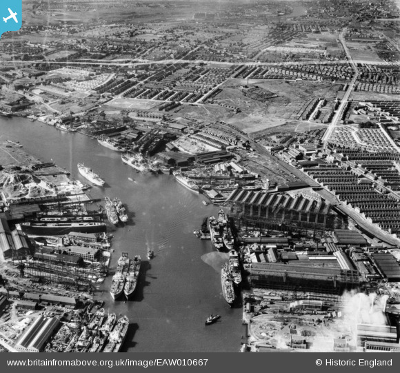
EAW010667 ENGLAND (1947). Shipyards on the River Tyne, Walker, 1947. This image was marked by Aerofilms Ltd for photo editing.
© Copyright OpenStreetMap contributors and licensed by the OpenStreetMap Foundation. 2026. Cartography is licensed as CC BY-SA.
Nearby Images (18)
EAW010667

EAW010672

EAW010671

EAW009383

EAW010673

EAW010677

EAW009382

EAW010668

EAW010661

EAW010675

EAW017460

EAW002153

EAW010666

EAW010660

EAW017462

EPW045966

EAW010665

EAW009384

Details
| Title | [EAW010667] Shipyards on the River Tyne, Walker, 1947. This image was marked by Aerofilms Ltd for photo editing. |
| Reference | EAW010667 |
| Date | 10-September-1947 |
| Link | |
| Place name | WALKER |
| Parish | |
| District | |
| Country | ENGLAND |
| Easting / Northing | 430015, 565515 |
| Longitude / Latitude | -1.5309330873826, 54.983254649775 |
| National Grid Reference | NZ300655 |
Pins
Be the first to add a comment to this image!