
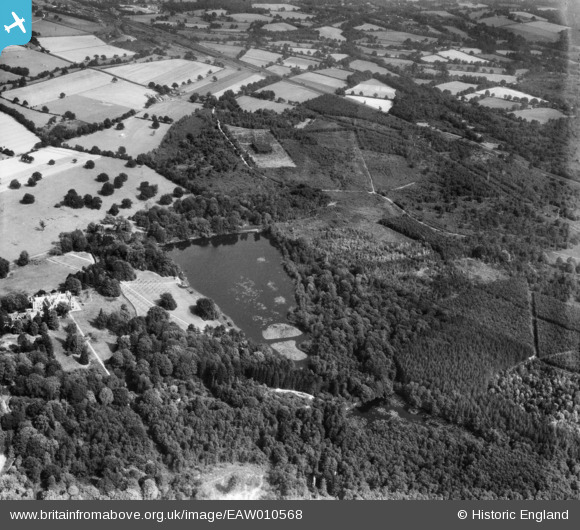
EAW010568 ENGLAND (1947). Tilgate Lake (Campbell's Lake) and surrounding forest and countryside, Tilgate, 1947
© Copyright OpenStreetMap contributors and licensed by the OpenStreetMap Foundation. 2026. Cartography is licensed as CC BY-SA.
Nearby Images (2)
EAW010568
 and surrounding forest and countryside, Tilgate, 1947")
EAW010571
 and surrounding forest, Tilgate, 1947")
Details
| Title | [EAW010568] Tilgate Lake (Campbell's Lake) and surrounding forest and countryside, Tilgate, 1947 |
| Reference | EAW010568 |
| Date | 3-September-1947 |
| Link | |
| Place name | TILGATE |
| Parish | |
| District | |
| Country | ENGLAND |
| Easting / Northing | 528068, 134560 |
| Longitude / Latitude | -0.17088149177867, 51.095497978638 |
| National Grid Reference | TQ281346 |
Pins

Bob |
Friday 15th of October 2021 08:20:12 AM | |
|
Bob |
Friday 15th of October 2021 08:16:00 AM | |
|
M Anton |
Monday 16th of April 2018 05:22:41 PM | |
|
M Anton |
Monday 16th of April 2018 05:19:03 PM | |
|
M Anton |
Monday 16th of April 2018 05:18:36 PM | |
|
tholl17 |
Sunday 6th of July 2014 06:48:33 PM | |
|
tholl17 |
Sunday 6th of July 2014 06:47:43 PM | |
|
tholl17 |
Sunday 6th of July 2014 06:47:02 PM |
User Comment Contributions
Furnace Farm is visible above the lake - two-thirds of the way between the lake and the top of the picture. Above and to the left can be see the storage sidings for Three Bridges station. |
Anne Okapi |
Saturday 23rd of November 2013 11:46:44 PM |