
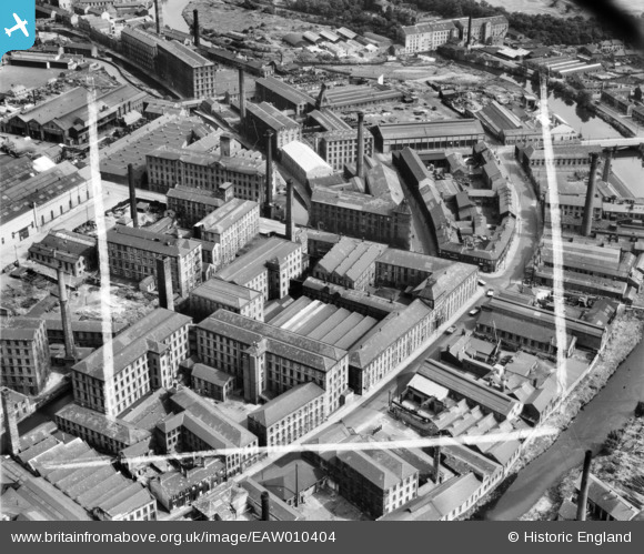
EAW010404 ENGLAND (1947). John Taylors Ltd Colne Road Mills, Huddersfield, 1947. This image was marked by Aerofilms Ltd for photo editing.
© Copyright OpenStreetMap contributors and licensed by the OpenStreetMap Foundation. 2026. Cartography is licensed as CC BY-SA.
Nearby Images (17)
EAW010404

EAW010405

EAW010406

EAW010402

EAW010407

EAW010401

EAW010403

EAW044206

EAW010400

EAW044209

EAW044205

EAW044207

EAW044208

EAW044203

EAW044201

EAW044202

EAW044204

Details
| Title | [EAW010404] John Taylors Ltd Colne Road Mills, Huddersfield, 1947. This image was marked by Aerofilms Ltd for photo editing. |
| Reference | EAW010404 |
| Date | 30-August-1947 |
| Link | |
| Place name | HUDDERSFIELD |
| Parish | |
| District | |
| Country | ENGLAND |
| Easting / Northing | 414488, 415953 |
| Longitude / Latitude | -1.78084314522, 53.639658632865 |
| National Grid Reference | SE145160 |
