
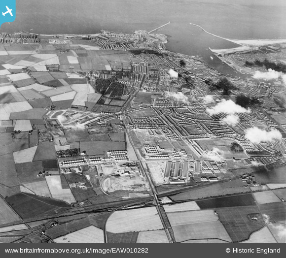
EAW010282 ENGLAND (1947). Development around Billy Mill and West Chirton, Billy Mill, from the west, 1947
© Copyright OpenStreetMap contributors and licensed by the OpenStreetMap Foundation. 2026. Cartography is licensed as CC BY-SA.
Nearby Images (5)
EAW010282

EAW010295

EAW010296

EAW010281

EAW010290

Details
| Title | [EAW010282] Development around Billy Mill and West Chirton, Billy Mill, from the west, 1947 |
| Reference | EAW010282 |
| Date | 24-August-1947 |
| Link | |
| Place name | BILLY MILL |
| Parish | |
| District | |
| Country | ENGLAND |
| Easting / Northing | 433143, 568805 |
| Longitude / Latitude | -1.4816706117557, 55.012623096258 |
| National Grid Reference | NZ331688 |
Pins
Be the first to add a comment to this image!