
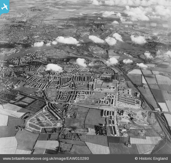
EAW010280 ENGLAND (1947). Development around West Chirton and Billy Mill, West Chirton, from the north, 1947
© Copyright OpenStreetMap contributors and licensed by the OpenStreetMap Foundation. 2026. Cartography is licensed as CC BY-SA.
Nearby Images (8)
EAW010280

EAW010287

EAW010286

EAW010294

EAW010293

EAW010284

EAW010288

EAW010285

Details
| Title | [EAW010280] Development around West Chirton and Billy Mill, West Chirton, from the north, 1947 |
| Reference | EAW010280 |
| Date | 24-August-1947 |
| Link | |
| Place name | WEST CHIRTON |
| Parish | |
| District | |
| Country | ENGLAND |
| Easting / Northing | 433575, 568869 |
| Longitude / Latitude | -1.4749072845537, 55.013169290271 |
| National Grid Reference | NZ336689 |
Pins

dave |
Sunday 15th of May 2016 09:10:47 AM | |
|
bellringer |
Wednesday 4th of June 2014 07:09:29 PM | |
|
Eric Hollerton |
Saturday 21st of December 2013 05:17:16 PM | |
|
Eric Hollerton |
Saturday 21st of December 2013 05:17:16 PM | |
|
Eric Hollerton |
Saturday 21st of December 2013 05:04:33 PM | |
|
Eric Hollerton |
Saturday 21st of December 2013 04:52:21 PM | |
|
Eric Hollerton |
Saturday 21st of December 2013 04:48:40 PM |