
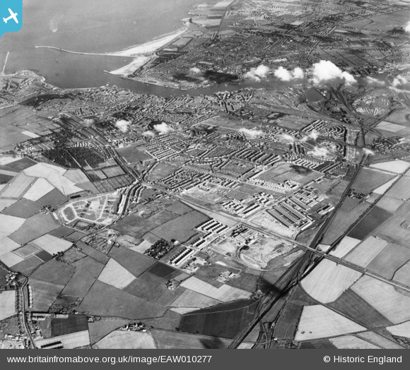
EAW010277 ENGLAND (1947). Development around Billy Mill and West Chirton, Billy Mill, from the north-west, 1947
© Copyright OpenStreetMap contributors and licensed by the OpenStreetMap Foundation. 2026. Cartography is licensed as CC BY-SA.
Nearby Images (2)
EAW010277

EAW010281

Details
| Title | [EAW010277] Development around Billy Mill and West Chirton, Billy Mill, from the north-west, 1947 |
| Reference | EAW010277 |
| Date | 24-August-1947 |
| Link | |
| Place name | BILLY MILL |
| Parish | |
| District | |
| Country | ENGLAND |
| Easting / Northing | 433011, 569082 |
| Longitude / Latitude | -1.4837029084282, 55.01512122403 |
| National Grid Reference | NZ330691 |
Pins

redmist |
Sunday 28th of January 2024 10:33:33 AM |