
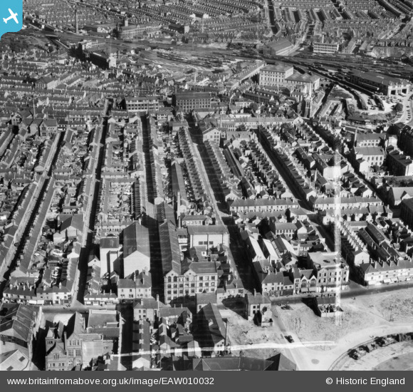
EAW010032 ENGLAND (1947). W. Raven & Co Hosiery Factory and environs, Leicester, 1947. This image was marked by Aerofilms Ltd for photo editing.
© Copyright OpenStreetMap contributors and licensed by the OpenStreetMap Foundation. 2026. Cartography is licensed as CC BY-SA.
Nearby Images (18)
EAW010032

EAW010036

EAW010037

EAW011744

EAW011745

EAW011748

EAW011751

EAW011749

EAW011746

EAW011747

EAW010034

EAW010033

EAW011750

EAW010031

EAW010038

EAW010035

EPW061208

EAW051833

Details
| Title | [EAW010032] W. Raven & Co Hosiery Factory and environs, Leicester, 1947. This image was marked by Aerofilms Ltd for photo editing. |
| Reference | EAW010032 |
| Date | 29-August-1947 |
| Link | |
| Place name | LEICESTER |
| Parish | |
| District | |
| Country | ENGLAND |
| Easting / Northing | 459309, 304916 |
| Longitude / Latitude | -1.123458492157, 52.638393974029 |
| National Grid Reference | SK593049 |
Pins
Be the first to add a comment to this image!