
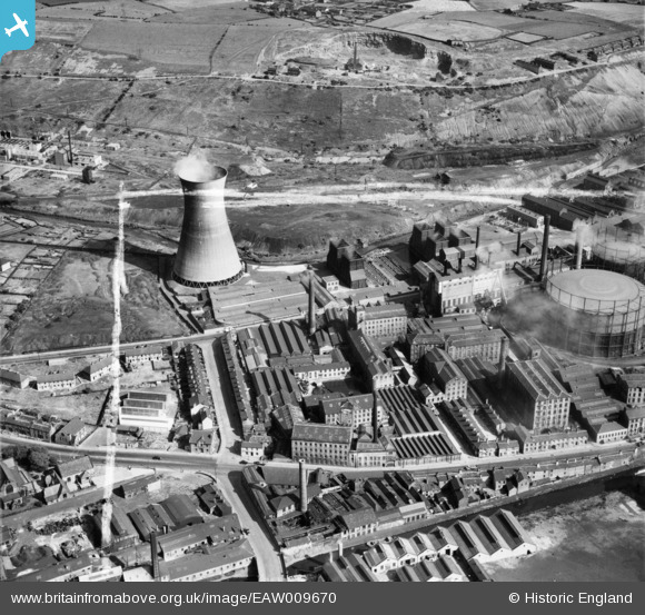
EAW009670 ENGLAND (1947). Textile mills between Leeds Road and St Andrew's Road, Huddersfield, 1947. This image was marked by Aerofilms Ltd for photo editing.
© Copyright OpenStreetMap contributors and licensed by the OpenStreetMap Foundation. 2026. Cartography is licensed as CC BY-SA.
Nearby Images (12)
EAW009670

EAW009687

EAW009672

EAW009675

EAW009688

EAW009689

EAW009671

EAW009674

EAW009686

EAW009668

EAW009673

EAW009669

Details
| Title | [EAW009670] Textile mills between Leeds Road and St Andrew's Road, Huddersfield, 1947. This image was marked by Aerofilms Ltd for photo editing. |
| Reference | EAW009670 |
| Date | 1-September-1947 |
| Link | |
| Place name | HUDDERSFIELD |
| Parish | |
| District | |
| Country | ENGLAND |
| Easting / Northing | 415078, 417462 |
| Longitude / Latitude | -1.7718452138572, 53.653206620538 |
| National Grid Reference | SE151175 |
Pins

Stan |
Wednesday 28th of January 2015 10:52:29 AM | |
|
Stan |
Wednesday 28th of January 2015 10:16:01 AM | |
|
Stan |
Wednesday 28th of January 2015 10:15:18 AM | |
|
Stan |
Wednesday 28th of January 2015 10:14:04 AM |