
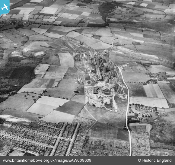
EAW009639 ENGLAND (1947). The John Lysaght Normanby Park Steel Works, Scunthorpe, 1947
© Copyright OpenStreetMap contributors and licensed by the OpenStreetMap Foundation. 2026. Cartography is licensed as CC BY-SA.
Nearby Images (48)
EAW009639

EAW016666

EAW038763

EAW038760

EAW034825

EAW038768

EAW038769

EAW034826

EAW016663

EAW041840

EAW049667

EAW038747

EAW041844

EAW041841

EAW021140

EAW031171

EAW041842

EAW041839

EPW048524

EPW048527

EPW048947

EAW041835

EAW041843

EAW041831

EAW038748

EAW034801

EAW016665

EAW034798

EAW041833

EAW009623

EAW023924

EAW041836

EAW009409

EAW034800

EAW027186

EPW048522

EAW034820

EAW049673

EAW016660

EAW041829

EAW009629

EAW009627

EAW009414

EPW048949

EPW048520

EAW027185

EAW049756

EPW048945

Details
| Title | [EAW009639] The John Lysaght Normanby Park Steel Works, Scunthorpe, 1947 |
| Reference | EAW009639 |
| Date | 16-August-1947 |
| Link | |
| Place name | SCUNTHORPE |
| Parish | |
| District | |
| Country | ENGLAND |
| Easting / Northing | 488773, 413542 |
| Longitude / Latitude | -0.65803481785621, 53.61066247109 |
| National Grid Reference | SE888135 |

