
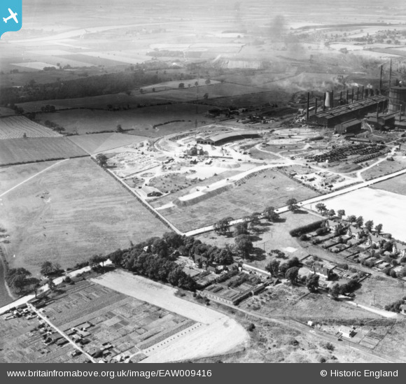
EAW009416 ENGLAND (1947). Noranby Road and the John Lysaght Normanby Park Steel Works, Scunthorpe, from the east, 1947. This image has been produced from a print.
© Copyright OpenStreetMap contributors and licensed by the OpenStreetMap Foundation. 2026. Cartography is licensed as CC BY-SA.
Nearby Images (8)
EAW009416

EAW019680

EAW021145
, Scunthorpe, from the south-east, 1949. This image has been produced from a damaged negative.")
EAW021144
, Scunthorpe, from the south-east, 1949. This image has been produced from a damaged negative.")
EAW028558

EAW027165

EAW031167

EAW031175

Details
| Title | [EAW009416] Noranby Road and the John Lysaght Normanby Park Steel Works, Scunthorpe, from the east, 1947. This image has been produced from a print. |
| Reference | EAW009416 |
| Date | 17-August-1947 |
| Link | |
| Place name | SCUNTHORPE |
| Parish | |
| District | |
| Country | ENGLAND |
| Easting / Northing | 489353, 412951 |
| Longitude / Latitude | -0.64943923330946, 53.605252656903 |
| National Grid Reference | SE894130 |
Pins
Be the first to add a comment to this image!