
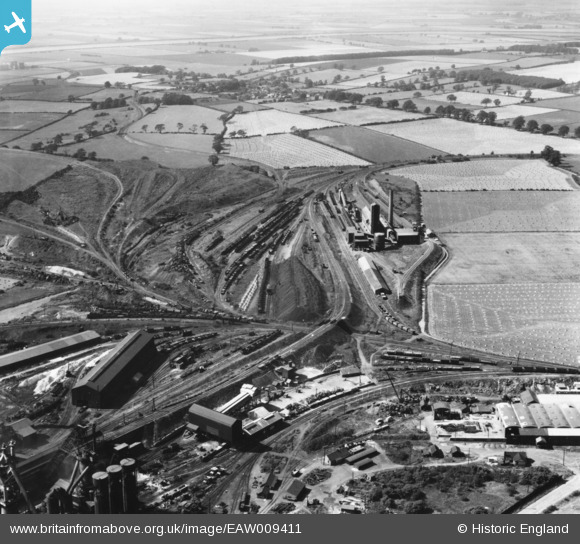
EAW009411 ENGLAND (1947). The John Lysaght Normanby Park Steel Works, Flixborough, from the south-east, 1947. This image has been produced from a print.
© Copyright OpenStreetMap contributors and licensed by the OpenStreetMap Foundation. 2026. Cartography is licensed as CC BY-SA.
Nearby Images (48)
EAW009411

EAW038776

EAW034811

EAW013489

EAW016662

EPW048528

EAW031193

EAW034805

EAW038778

EAW034824

EAW027181

EAW041854

EAW041847

EAW027179

EAW038775

EAW031195

EAW031196

EAW034804

EAW041852

EAW041858

EAW028563

EAW028560

EAW041857

EAW027180

EAW049674

EAW028564

EAW016661

EAW028561

EAW041853

EAW027177

EAW041856

EAW049663

EAW041855

EAW041859

EAW023927

EAW049669

EAW049665

EAW009636

EAW028562

EAW019674

EAW038761

EAW034812

EAW041827

EAW034806

EAW009634

EAW041860

EAW041864

EAW009638

Details
| Title | [EAW009411] The John Lysaght Normanby Park Steel Works, Flixborough, from the south-east, 1947. This image has been produced from a print. |
| Reference | EAW009411 |
| Date | 17-August-1947 |
| Link | |
| Place name | FLIXBOROUGH |
| Parish | |
| District | |
| Country | ENGLAND |
| Easting / Northing | 488744, 414081 |
| Longitude / Latitude | -0.65831949295103, 53.61551128368 |
| National Grid Reference | SE887141 |
Pins

DaveH |
Monday 6th of January 2020 05:47:24 PM |