
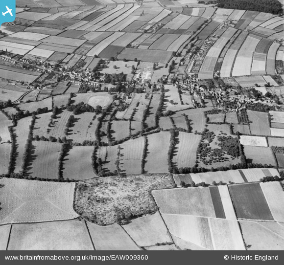
EAW009360 ENGLAND (1947). The village, Calverton, 1947
© Copyright OpenStreetMap contributors and licensed by the OpenStreetMap Foundation. 2026. Cartography is licensed as CC BY-SA.
Nearby Images (2)
EAW009360

EAW009364

Details
| Title | [EAW009360] The village, Calverton, 1947 |
| Reference | EAW009360 |
| Date | 17-August-1947 |
| Link | |
| Place name | CALVERTON |
| Parish | CALVERTON |
| District | |
| Country | ENGLAND |
| Easting / Northing | 461393, 348863 |
| Longitude / Latitude | -1.0843918677262, 53.033216158841 |
| National Grid Reference | SK614489 |
Pins
Be the first to add a comment to this image!
User Comment Contributions
Note the cricket ground to the left (West) of centre of photo and also new Basford Rural District Council housing (Manor Road) under construction just North of centre of photo. |

JasAloysius |
Thursday 8th of May 2014 08:51:31 PM |