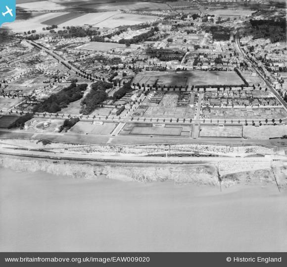
EAW009020 ENGLAND (1947). West Cliff and the residential area surrounding London Road, Ramsgate, 1947
    © Copyright OpenStreetMap contributors and licensed by the OpenStreetMap Foundation. 2025. Cartography is licensed as CC BY-SA.
  
Nearby Images (15)
Details
| Title | [EAW009020] West Cliff and the residential area surrounding London Road, Ramsgate, 1947 | 
| Reference | EAW009020 | 
| Date | 12-August-1947 | 
| Link | |
| Place name | RAMSGATE | 
| Parish | RAMSGATE | 
| District | |
| Country | ENGLAND | 
| Easting / Northing | 637311, 164206 | 
| Longitude / Latitude | 1.4067144500149, 51.326851488499 | 
| National Grid Reference | TR373642 | 
Pins
|  Lorne Road |   CatherineE | Wednesday 14th of September 2022 06:24:22 PM | 
|  WW2 Pillbox TBC |   Sparky | Thursday 6th of July 2017 09:19:12 PM | 
 
             
  ![[EAW009020] West Cliff and the residential area surrounding London Road, Ramsgate, 1947](http://britainfromabove.org.uk/sites/all/libraries/aerofilms-images/public/100x100/EAW/009/EAW009020.jpg) 
  
                                          ![[EPW013300] Royal Esplanade looking towards Royal Harbour and the town, Ramsgate, 1925. This image has been produced from a print.](http://britainfromabove.org.uk/sites/all/libraries/aerofilms-images/public/100x100/EPW/013/EPW013300.jpg) 
 ![[EAW009019] West Cliff and the residential area surrounding London Road, Ramsgate, 1947](http://britainfromabove.org.uk/sites/all/libraries/aerofilms-images/public/100x100/EAW/009/EAW009019.jpg) 
 ![[EPW052887] The town and seafront, Ramsgate, from the south-west, 1937. This image has been produced from a print.](http://britainfromabove.org.uk/sites/all/libraries/aerofilms-images/public/100x100/EPW/052/EPW052887.jpg) 
 ![[EPW039355] Band Stand on Prince Edward's Promenade, Ramsgate, 1932](http://britainfromabove.org.uk/sites/all/libraries/aerofilms-images/public/100x100/EPW/039/EPW039355.jpg) 
 ![[EPW042860] Band Stand on Prince Edward's Promenade and environs, Ramsgate, 1933](http://britainfromabove.org.uk/sites/all/libraries/aerofilms-images/public/100x100/EPW/042/EPW042860.jpg) 
 ![[EAW009027] The Prince Edward's Promenade Band Stand, Ramsgate, 1947](http://britainfromabove.org.uk/sites/all/libraries/aerofilms-images/public/100x100/EAW/009/EAW009027.jpg) 
 ![[EPW042863] Band Stand on Prince Edward's Promenade and environs, Ramsgate, 1933](http://britainfromabove.org.uk/sites/all/libraries/aerofilms-images/public/100x100/EPW/042/EPW042863.jpg) 
 ![[EPW039347] Band Stand on Prince Edward's Promenade, Ramsgate, 1932](http://britainfromabove.org.uk/sites/all/libraries/aerofilms-images/public/100x100/EPW/039/EPW039347.jpg) 
 ![[EAW009000] Prince Edward's Promenade Band Stand, West Cliff and the seafront, Ramsgate, 1947](http://britainfromabove.org.uk/sites/all/libraries/aerofilms-images/public/100x100/EAW/009/EAW009000.jpg) 
 ![[EAW009021] West Cliff, Grange Road and the surrounding area, Ramsgate, 1947](http://britainfromabove.org.uk/sites/all/libraries/aerofilms-images/public/100x100/EAW/009/EAW009021.jpg) 
 ![[EAW009026] The Prince Edward's Promenade Band Stand, Ramsgate, 1947](http://britainfromabove.org.uk/sites/all/libraries/aerofilms-images/public/100x100/EAW/009/EAW009026.jpg) 
 ![[EPW013299] Grange Road and environs, Ramsgate, 1925. This image has been produced from a copy-negative.](http://britainfromabove.org.uk/sites/all/libraries/aerofilms-images/public/100x100/EPW/013/EPW013299.jpg) 
 ![[EAW009001] West Cliff, Royal Harbour and the town, Ramsgate, 1947](http://britainfromabove.org.uk/sites/all/libraries/aerofilms-images/public/100x100/EAW/009/EAW009001.jpg) 
 ![[EPW042858] West Cliff, the Royal Harbour and the town, Ramsgate, from the south-west, 1933](http://britainfromabove.org.uk/sites/all/libraries/aerofilms-images/public/100x100/EPW/042/EPW042858.jpg)