
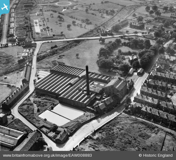
EAW008883 ENGLAND (1947). The Leafield Woollen Mills, Yeadon, 1947
© Copyright OpenStreetMap contributors and licensed by the OpenStreetMap Foundation. 2026. Cartography is licensed as CC BY-SA.
Nearby Images (22)
EAW008883

EAW036907

EAW036909

EPW024447

EAW008877

EAW036908

EAW036910

EAW036906

EAW008884

EPW024446

EAW008879

EAW008881

EAW008882

EAW036904

EAW008878

EAW008885

EAW036905

EAW008880

EAW036912

EAW036911

EPW024449

EPW024445

Details
| Title | [EAW008883] The Leafield Woollen Mills, Yeadon, 1947 |
| Reference | EAW008883 |
| Date | 9-August-1947 |
| Link | |
| Place name | YEADON |
| Parish | |
| District | |
| Country | ENGLAND |
| Easting / Northing | 420119, 441100 |
| Longitude / Latitude | -1.6940271198453, 53.865517637117 |
| National Grid Reference | SE201411 |
Pins
Be the first to add a comment to this image!