
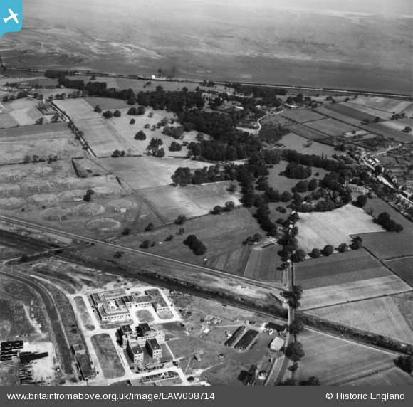
EAW008714 ENGLAND (1947). Ince Hall and the surrounding area, Stanlow, 1947. This image has been produced from a print.
© Copyright OpenStreetMap contributors and licensed by the OpenStreetMap Foundation. 2026. Cartography is licensed as CC BY-SA.
Nearby Images (2)
EAW008714

EAW008704

Details
| Title | [EAW008714] Ince Hall and the surrounding area, Stanlow, 1947. This image has been produced from a print. |
| Reference | EAW008714 |
| Date | 1-August-1947 |
| Link | |
| Place name | STANLOW |
| Parish | |
| District | |
| Country | ENGLAND |
| Easting / Northing | 344748, 376272 |
| Longitude / Latitude | -2.8287646442344, 53.280266493212 |
| National Grid Reference | SJ447763 |
Pins

redmist |
Thursday 10th of November 2022 09:07:31 PM | |

Matt Aldred edob.mattaldred.com |
Thursday 11th of March 2021 05:08:29 PM | |

Sparky |
Friday 13th of October 2017 08:13:51 AM | |
|
Sparky |
Friday 13th of October 2017 08:13:10 AM |