
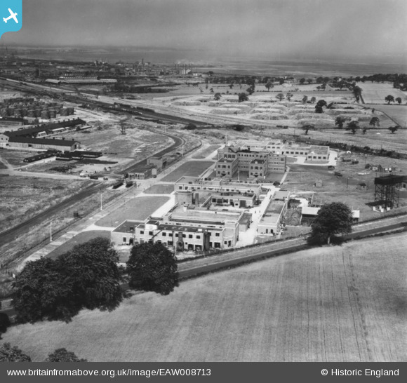
EAW008713 ENGLAND (1947). The Thornton Research Centre, Stanlow, from the east, 1947. This image has been produced from a print.
© Copyright OpenStreetMap contributors and licensed by the OpenStreetMap Foundation. 2026. Cartography is licensed as CC BY-SA.
Nearby Images (7)
EAW008713

EAW008710

EAW008712

EAW008709

EAW008707

EAW008708

EAW008691

Details
| Title | [EAW008713] The Thornton Research Centre, Stanlow, from the east, 1947. This image has been produced from a print. |
| Reference | EAW008713 |
| Date | 1-August-1947 |
| Link | |
| Place name | STANLOW |
| Parish | |
| District | |
| Country | ENGLAND |
| Easting / Northing | 344977, 375648 |
| Longitude / Latitude | -2.8252220496658, 53.274681260726 |
| National Grid Reference | SJ450756 |
Pins

Sparky |
Friday 29th of September 2017 10:24:25 PM | |

beast66606 |
Friday 19th of September 2014 11:13:46 PM |