
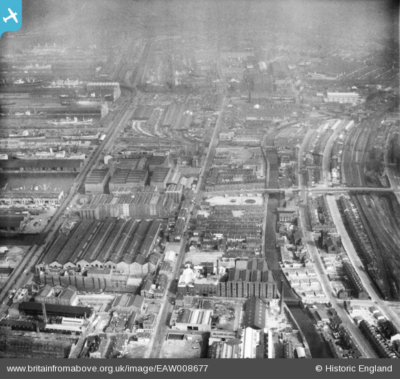
EAW008677 ENGLAND (1947). The Harland and Wolff Shipbuilding and Engineering Works, Bootle, from the south-east, 1947
© Copyright OpenStreetMap contributors and licensed by the OpenStreetMap Foundation. 2026. Cartography is licensed as CC BY-SA.
Nearby Images (9)
EAW008677

EAW008675

EAW008676

EAW008686

EAW008674

EAW008679

EAW008673

EAW008680

EAW008685

Details
| Title | [EAW008677] The Harland and Wolff Shipbuilding and Engineering Works, Bootle, from the south-east, 1947 |
| Reference | EAW008677 |
| Date | 1-August-1947 |
| Link | |
| Place name | BOOTLE |
| Parish | |
| District | |
| Country | ENGLAND |
| Easting / Northing | 333858, 394329 |
| Longitude / Latitude | -2.9958641104752, 53.441321700002 |
| National Grid Reference | SJ339943 |
Pins

Rachel |
Thursday 11th of January 2024 10:09:28 PM | |
|
Rachel |
Thursday 11th of January 2024 10:08:11 PM | |
|
Rachel |
Thursday 11th of January 2024 10:07:16 PM | |
|
Rachel |
Thursday 11th of January 2024 10:06:24 PM | |
|
bob |
Sunday 20th of November 2022 11:10:51 AM | |
|
bob |
Sunday 20th of November 2022 11:07:09 AM | |
|
redmist |
Friday 12th of February 2021 04:43:11 PM | |
|
bob |
Sunday 31st of January 2021 07:52:07 PM | |
|
bob |
Sunday 31st of January 2021 07:50:20 PM | |
|
bob |
Tuesday 30th of July 2019 05:45:48 PM | |
|
bob |
Tuesday 30th of July 2019 01:17:40 PM | |
|
bob |
Tuesday 30th of July 2019 01:16:28 PM | |
|
bob |
Tuesday 30th of July 2019 01:15:10 PM | |
|
bob |
Tuesday 30th of July 2019 01:14:46 PM | |
|
oldliverpoolrailways |
Friday 9th of March 2018 03:38:10 PM | |
|
morris minor |
Sunday 5th of October 2014 05:42:41 PM |