
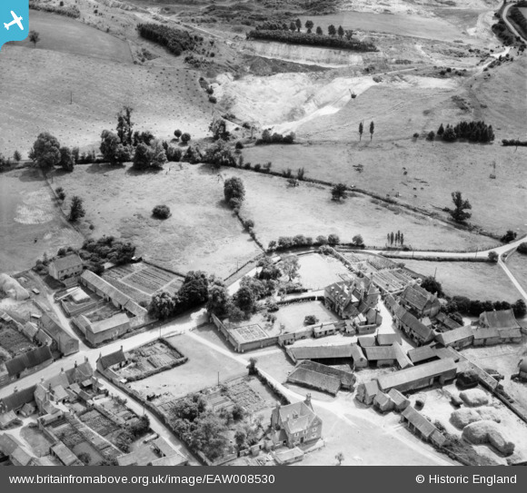
EAW008530 ENGLAND (1947). Manor House and Farm, Sudborough, 1947
© Copyright OpenStreetMap contributors and licensed by the OpenStreetMap Foundation. 2026. Cartography is licensed as CC BY-SA.
Nearby Images (8)
EAW008530

EAW008531

EAW008528

EAW008529

EAW008532

EAW008533

EAW008534

EAW008535

Details
| Title | [EAW008530] Manor House and Farm, Sudborough, 1947 |
| Reference | EAW008530 |
| Date | 22-July-1947 |
| Link | |
| Place name | SUDBOROUGH |
| Parish | SUDBOROUGH |
| District | |
| Country | ENGLAND |
| Easting / Northing | 496589, 282010 |
| Longitude / Latitude | -0.5792995870556, 52.427155703458 |
| National Grid Reference | SP966820 |
Pins
Be the first to add a comment to this image!