
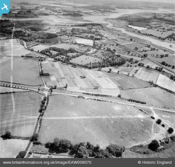
EAW008070 ENGLAND (1947). The A12, Ipswich Road and environs, Martlesham, from the north-west, 1947. This image was marked by Aerofilms Ltd for photo editing.
© Copyright OpenStreetMap contributors and licensed by the OpenStreetMap Foundation. 2026. Cartography is licensed as CC BY-SA.
Nearby Images (2)
EAW008070

EAW008069

Details
| Title | [EAW008070] The A12, Ipswich Road and environs, Martlesham, from the north-west, 1947. This image was marked by Aerofilms Ltd for photo editing. |
| Reference | EAW008070 |
| Date | 12-July-1947 |
| Link | |
| Place name | MARTLESHAM |
| Parish | MARTLESHAM |
| District | |
| Country | ENGLAND |
| Easting / Northing | 625430, 248174 |
| Longitude / Latitude | 1.2907632063135, 52.085515044707 |
| National Grid Reference | TM254482 |
Pins

Matt Aldred edob.mattaldred.com |
Thursday 11th of March 2021 05:43:50 PM | |
|
Matt Aldred edob.mattaldred.com |
Thursday 11th of March 2021 05:42:54 PM | |

Sparky |
Monday 2nd of October 2017 09:57:00 PM | |
|
Sparky |
Monday 2nd of October 2017 09:55:02 PM | |
|
Sparky |
Monday 2nd of October 2017 09:53:34 PM | |

Al |
Thursday 30th of January 2014 12:56:23 AM | |
|
cptpies |
Tuesday 14th of January 2014 11:23:14 AM |
User Comment Contributions

HAA Battery remnants. |
cptpies |
Tuesday 14th of January 2014 11:24:33 AM |