
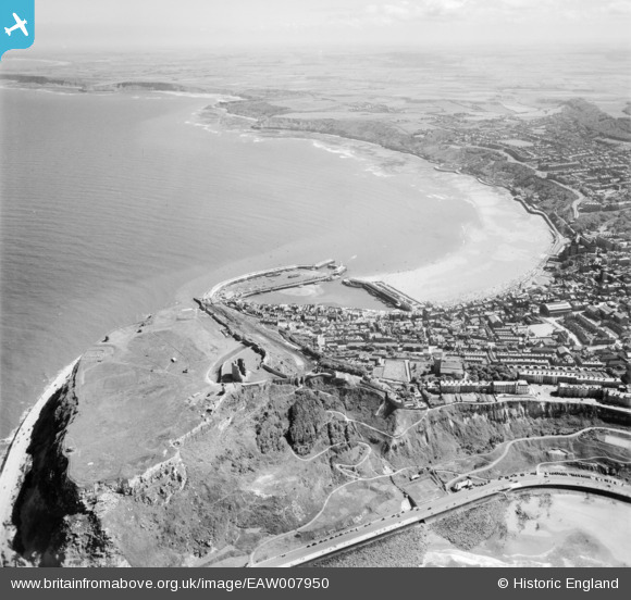
EAW007950 ENGLAND (1947). The castle and South Bay, Scarborough, from the north, 1947
© Copyright OpenStreetMap contributors and licensed by the OpenStreetMap Foundation. 2026. Cartography is licensed as CC BY-SA.
Nearby Images (15)
EAW007950

EAW016696

EAW016695

EAW007949

EAW016699

EAW005720

EAW005719

EPW029093

EAW005718

EAW005722

EAW016698

EAW005721

EAW005717

EAW005716

EAW016697

Details
| Title | [EAW007950] The castle and South Bay, Scarborough, from the north, 1947 |
| Reference | EAW007950 |
| Date | 26-June-1947 |
| Link | |
| Place name | SCARBOROUGH |
| Parish | |
| District | |
| Country | ENGLAND |
| Easting / Northing | 504813, 489223 |
| Longitude / Latitude | -0.38966504355536, 54.287714690066 |
| National Grid Reference | TA048892 |
Pins

Matt Aldred edob.mattaldred.com |
Friday 7th of May 2021 03:38:58 PM | |

redmist |
Thursday 12th of September 2019 08:20:58 PM | |
|
redmist |
Thursday 12th of September 2019 08:39:25 AM | |
|
Chris Kolonko |
Tuesday 12th of September 2017 10:05:02 PM | |

Alan McFaden |
Wednesday 15th of January 2014 07:14:12 PM | |
|
Alan McFaden |
Wednesday 15th of January 2014 07:13:44 PM | |
|
Alan McFaden |
Wednesday 15th of January 2014 07:13:13 PM | |
|
Alan McFaden |
Wednesday 15th of January 2014 07:11:49 PM | |
|
Alan McFaden |
Wednesday 15th of January 2014 07:11:08 PM |


