
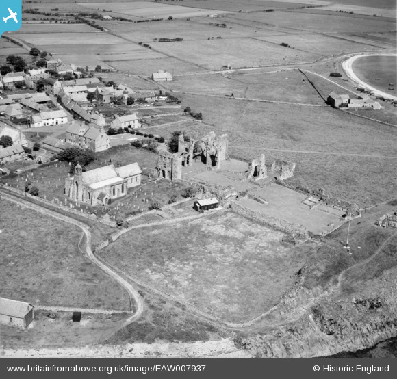
EAW007937 ENGLAND (1947). St Mary's Church and the remains of Lindisfarne Priory, Holy Island, 1947
© Copyright OpenStreetMap contributors and licensed by the OpenStreetMap Foundation. 2026. Cartography is licensed as CC BY-SA.
Nearby Images (16)
EAW007937

EAW034337

EAW006096

EAW007934

EAW007936

EAW034334

EAW034338

EAW007932

EAW034339

EAW034335

EAW034336

EAW006097

EAW007933

EAW006095

EAW007935

EAW006094

Details
| Title | [EAW007937] St Mary's Church and the remains of Lindisfarne Priory, Holy Island, 1947 |
| Reference | EAW007937 |
| Date | 27-June-1947 |
| Link | |
| Place name | HOLY ISLAND |
| Parish | HOLY ISLAND |
| District | |
| Country | ENGLAND |
| Easting / Northing | 412605, 641759 |
| Longitude / Latitude | -1.7995814441808, 55.669180119933 |
| National Grid Reference | NU126418 |
Pins
 |

melgibbs |
Friday 4th of November 2016 08:49:53 PM |