
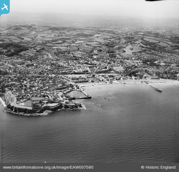
EAW007580 ENGLAND (1947). Paignton Harbour, Paignton Sands and the town, Paignton, from the east, 1947
© Copyright OpenStreetMap contributors and licensed by the OpenStreetMap Foundation. 2025. Cartography is licensed as CC BY-SA.
Nearby Images (2)
EAW007580

EAW007579

Details
| Title | [EAW007580] Paignton Harbour, Paignton Sands and the town, Paignton, from the east, 1947 |
| Reference | EAW007580 |
| Date | 25-June-1947 |
| Link | |
| Place name | PAIGNTON |
| Parish | |
| District | |
| Country | ENGLAND |
| Easting / Northing | 289796, 60297 |
| Longitude / Latitude | -3.5518397776387, 50.431564545909 |
| National Grid Reference | SX898603 |
Pins

RBRAY |
Friday 21st of January 2022 12:27:56 PM | |
|
Mark B |
Tuesday 17th of April 2018 08:51:43 PM | |
|
Mark B |
Tuesday 17th of April 2018 08:49:04 PM | |
|
Mark B |
Tuesday 17th of April 2018 08:47:31 PM | |
|
Mark B |
Tuesday 17th of April 2018 08:46:41 PM | |
|
Mark B |
Tuesday 17th of April 2018 08:44:50 PM | |
|
Mark B |
Tuesday 17th of April 2018 08:43:21 PM | |
|
Mark B |
Tuesday 17th of April 2018 08:42:40 PM | |
|
Mark B |
Tuesday 17th of April 2018 08:41:59 PM | |
|
Mark B |
Tuesday 17th of April 2018 08:40:44 PM | |

Goldenhammerman |
Friday 21st of February 2014 06:36:03 PM |