
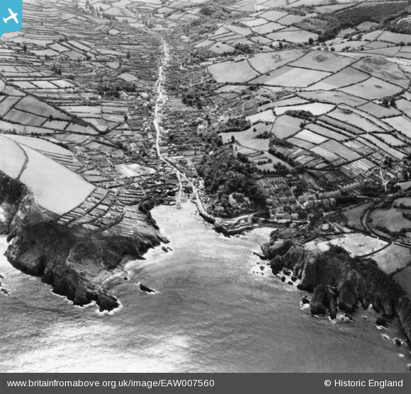
EAW007560 ENGLAND (1947). Lester Point, Combe Martin Beach and the village, Combe Martin, 1947. This image has been produced from a print.
© Copyright OpenStreetMap contributors and licensed by the OpenStreetMap Foundation. 2026. Cartography is licensed as CC BY-SA.
Nearby Images (2)
EAW007560

EPW033239

Details
| Title | [EAW007560] Lester Point, Combe Martin Beach and the village, Combe Martin, 1947. This image has been produced from a print. |
| Reference | EAW007560 |
| Date | 25-June-1947 |
| Link | |
| Place name | COMBE MARTIN |
| Parish | COMBE MARTIN |
| District | |
| Country | ENGLAND |
| Easting / Northing | 257744, 147153 |
| Longitude / Latitude | -4.0366048287944, 51.205331369031 |
| National Grid Reference | SS577472 |
Pins

Matt Aldred edob.mattaldred.com |
Friday 30th of May 2025 08:18:10 PM |