
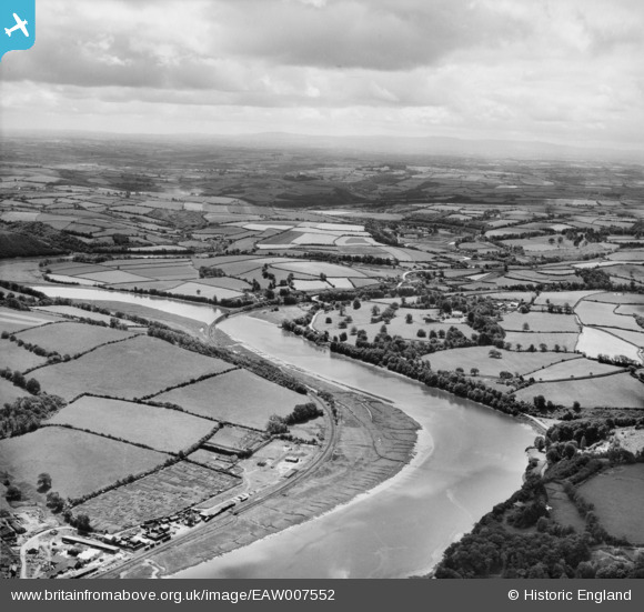
EAW007552 ENGLAND (1947). The River Torridge, East-the-Water, from the north-west, 1947
© Copyright OpenStreetMap contributors and licensed by the OpenStreetMap Foundation. 2026. Cartography is licensed as CC BY-SA.
Nearby Images (2)
EAW007552

EAW007551

Details
| Title | [EAW007552] The River Torridge, East-the-Water, from the north-west, 1947 |
| Reference | EAW007552 |
| Date | 25-June-1947 |
| Link | |
| Place name | EAST-THE-WATER |
| Parish | BIDEFORD |
| District | |
| Country | ENGLAND |
| Easting / Northing | 245668, 125266 |
| Longitude / Latitude | -4.1999975507786, 51.005509426941 |
| National Grid Reference | SS457253 |
Pins

Sparky |
Sunday 8th of October 2017 04:21:16 PM |