
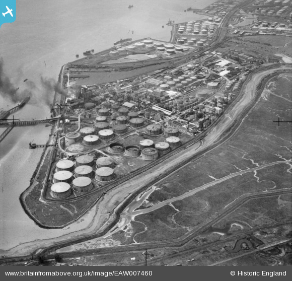
EAW007460 ENGLAND (1947). Part of the Coryton Oil Refinery complex, Coryton, 1947
© Copyright OpenStreetMap contributors and licensed by the OpenStreetMap Foundation. 2026. Cartography is licensed as CC BY-SA.
Nearby Images (12)
EAW007460

EAW043879

EAW047430

EAW007456

EAW003538

EAW007461

EAW007451

EAW007449

EAW003537

EAW048367

EAW047427

EAW007450

Details
| Title | [EAW007460] Part of the Coryton Oil Refinery complex, Coryton, 1947 |
| Reference | EAW007460 |
| Date | 25-June-1947 |
| Link | |
| Place name | CORYTON |
| Parish | |
| District | |
| Country | ENGLAND |
| Easting / Northing | 574510, 181961 |
| Longitude / Latitude | 0.51501577876313, 51.509107556722 |
| National Grid Reference | TQ745820 |
Pins

cptpies |
Tuesday 10th of October 2017 03:59:43 PM |