
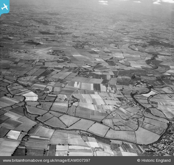
EAW007397 ENGLAND (1947). The River Avon at Fladbury looking towards RAF Pershore and beyond, Fladbury, from the south, 1947
© Copyright OpenStreetMap contributors and licensed by the OpenStreetMap Foundation. 2026. Cartography is licensed as CC BY-SA.
Nearby Images (3)
EAW007397

EAW007392

EAW007390

Details
| Title | [EAW007397] The River Avon at Fladbury looking towards RAF Pershore and beyond, Fladbury, from the south, 1947 |
| Reference | EAW007397 |
| Date | 12-June-1947 |
| Link | |
| Place name | FLADBURY |
| Parish | FLADBURY |
| District | |
| Country | ENGLAND |
| Easting / Northing | 398757, 246037 |
| Longitude / Latitude | -2.0181533709165, 52.112243842921 |
| National Grid Reference | SO988460 |
Pins

Ootie |
Friday 24th of May 2024 02:38:59 PM |
