
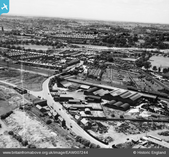
EAW007244 ENGLAND (1947). The Parker Foundry on Mansfield Road and environs, Derby, from the north-east, 1947.This image was marked by Aerofilms Ltd for photo editing.
© Copyright OpenStreetMap contributors and licensed by the OpenStreetMap Foundation. 2026. Cartography is licensed as CC BY-SA.
Nearby Images (9)
EAW007244

EAW007241

EAW007239

EAW007246

EAW007247

EAW007245

EAW007240

EAW007242

EAW007243

Details
| Title | [EAW007244] The Parker Foundry on Mansfield Road and environs, Derby, from the north-east, 1947.This image was marked by Aerofilms Ltd for photo editing. |
| Reference | EAW007244 |
| Date | 25-June-1947 |
| Link | |
| Place name | DERBY |
| Parish | |
| District | |
| Country | ENGLAND |
| Easting / Northing | 436003, 337720 |
| Longitude / Latitude | -1.4642715957166, 52.935354121858 |
| National Grid Reference | SK360377 |
Pins

HelsyB |
Thursday 5th of October 2023 05:13:02 PM | |

Sparky |
Sunday 8th of October 2017 04:01:24 PM | |
|
Sparky |
Sunday 8th of October 2017 04:00:33 PM | |
|
lather30 |
Friday 29th of November 2013 05:27:48 PM | |

Peter Kazmierczak |
Sunday 24th of November 2013 01:06:38 PM | |
|
Peter Kazmierczak |
Sunday 24th of November 2013 01:05:36 PM |