
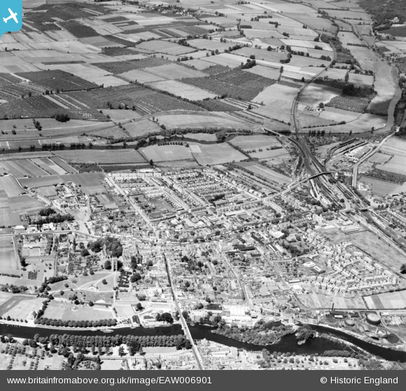
EAW006901 ENGLAND (1947). The town, Evesham, from the south-east, 1947
© Copyright OpenStreetMap contributors and licensed by the OpenStreetMap Foundation. 2026. Cartography is licensed as CC BY-SA.
Nearby Images (20)
EAW006901

EPW023909

EPW048026

EAW006900

EAW006898

EAW006899

EAW039998

EAW006892

EAW039997

EAW039992

EAW006891

EPW048025

EAW039995

EPW048082

EAW039994

EAW039996

EPW048024

EPW023911

EPW023906

EPW014619

Details
| Title | [EAW006901] The town, Evesham, from the south-east, 1947 |
| Reference | EAW006901 |
| Date | 10-June-1947 |
| Link | |
| Place name | EVESHAM |
| Parish | EVESHAM |
| District | |
| Country | ENGLAND |
| Easting / Northing | 403766, 243925 |
| Longitude / Latitude | -1.9450228885767, 52.09324219803 |
| National Grid Reference | SP038439 |
Pins

DRS |
Monday 29th of June 2020 12:04:56 PM | |
|
DRS |
Monday 29th of June 2020 12:03:45 PM | |
|
DRS |
Monday 29th of June 2020 12:02:15 PM | |
|
DRS |
Monday 29th of June 2020 12:01:03 PM | |
|
DRS |
Monday 29th of June 2020 11:59:38 AM | |
|
DRS |
Monday 29th of June 2020 11:57:37 AM | |
|
DRS |
Monday 29th of June 2020 11:57:02 AM |