
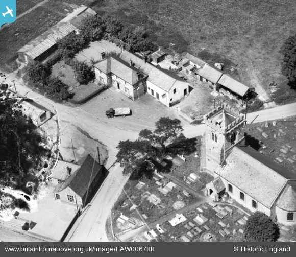
EAW006788 ENGLAND (1947). The Cross Keys Inn and St Mary's Church, Kinnerley, 1947. This image has been produced from a damaged negative.
© Copyright OpenStreetMap contributors and licensed by the OpenStreetMap Foundation. 2026. Cartography is licensed as CC BY-SA.
Nearby Images (4)
EAW006788

EAW006787

EAW006789

EAW006790

Details
| Title | [EAW006788] The Cross Keys Inn and St Mary's Church, Kinnerley, 1947. This image has been produced from a damaged negative. |
| Reference | EAW006788 |
| Date | 28-May-1947 |
| Link | |
| Place name | KINNERLEY |
| Parish | KINNERLEY |
| District | |
| Country | ENGLAND |
| Easting / Northing | 333786, 320942 |
| Longitude / Latitude | -2.9818054515864, 52.781658378796 |
| National Grid Reference | SJ338209 |
Pins
Be the first to add a comment to this image!