
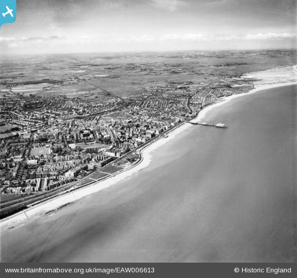
EAW006613 ENGLAND (1947). The seafront and town, Eastbourne, from the south, 1947
© Copyright OpenStreetMap contributors and licensed by the OpenStreetMap Foundation. 2026. Cartography is licensed as CC BY-SA.
Nearby Images (6)
EAW006613

EAW006614

EPW000084

EAW026327
, Eastbourne, 1949")
EPW051369
, Eastbourne, 1936")
EPW039413
, the Grand Parade and the seafront, Eastbourne, from the south, 1932")
Details
| Title | [EAW006613] The seafront and town, Eastbourne, from the south, 1947 |
| Reference | EAW006613 |
| Date | 27-May-1947 |
| Link | |
| Place name | EASTBOURNE |
| Parish | |
| District | |
| Country | ENGLAND |
| Easting / Northing | 561558, 98032 |
| Longitude / Latitude | 0.29087840698839, 50.758794366829 |
| National Grid Reference | TV616980 |
Pins

redmist |
Monday 27th of November 2023 05:16:34 PM | |
|
redmist |
Monday 27th of November 2023 05:14:34 PM | |
|
redmist |
Monday 27th of November 2023 05:14:13 PM | |

Alan McFaden |
Sunday 12th of January 2014 07:46:40 PM | |
|
Alan McFaden |
Sunday 12th of January 2014 07:46:06 PM | |
|
Alan McFaden |
Sunday 12th of January 2014 07:45:15 PM | |
|
Alan McFaden |
Sunday 12th of January 2014 07:44:34 PM | |
|
Alan McFaden |
Sunday 12th of January 2014 07:43:39 PM | |
|
Alan McFaden |
Sunday 12th of January 2014 07:42:43 PM | |
|
Alan McFaden |
Sunday 12th of January 2014 07:42:13 PM |


