
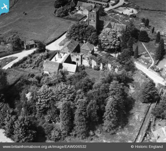
EAW006532 ENGLAND (1947). St Briavels Castle and St Mary's Church, St Briavels, 1947. This image has been produced from a print.
© Copyright OpenStreetMap contributors and licensed by the OpenStreetMap Foundation. 2026. Cartography is licensed as CC BY-SA.
Nearby Images (4)
EAW006532

EAW006530

EAW006531

EAW006529

Details
| Title | [EAW006532] St Briavels Castle and St Mary's Church, St Briavels, 1947. This image has been produced from a print. |
| Reference | EAW006532 |
| Date | 31-May-1947 |
| Link | |
| Place name | ST BRIAVELS |
| Parish | ST. BRIAVELS |
| District | |
| Country | ENGLAND |
| Easting / Northing | 355866, 204575 |
| Longitude / Latitude | -2.6392145457603, 51.737686748484 |
| National Grid Reference | SO559046 |
Pins
Be the first to add a comment to this image!


