
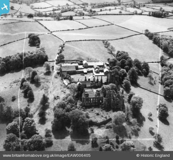
EAW006405 ENGLAND (1947). The ruins of Wingfield Manor House and Manor Farm, South Wingfield, 1947. This image has been produced from a print marked by Aerofilms Ltd for photo editing.
© Copyright OpenStreetMap contributors and licensed by the OpenStreetMap Foundation. 2025. Cartography is licensed as CC BY-SA.
Nearby Images (6)
EAW006405

EAW006404

EAW006403

EAW006406

EAW006407

EAW006402

Details
| Title | [EAW006405] The ruins of Wingfield Manor House and Manor Farm, South Wingfield, 1947. This image has been produced from a print marked by Aerofilms Ltd for photo editing. |
| Reference | EAW006405 |
| Date | 27-May-1947 |
| Link | |
| Place name | SOUTH WINGFIELD |
| Parish | SOUTH WINGFIELD |
| District | |
| Country | ENGLAND |
| Easting / Northing | 437420, 354707 |
| Longitude / Latitude | -1.4412185470062, 53.087966486994 |
| National Grid Reference | SK374547 |
Pins
Be the first to add a comment to this image!