
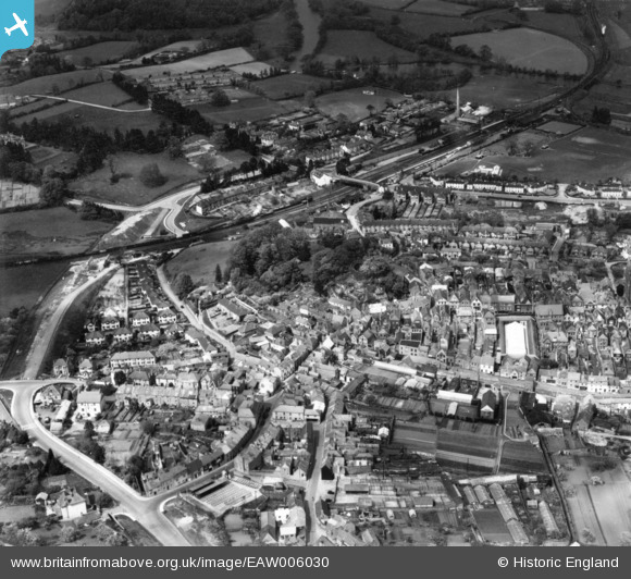
EAW006030 ENGLAND (1947). Totnes Castle and the town centre, Totnes, 1947. This image has been produced from a print.
© Copyright OpenStreetMap contributors and licensed by the OpenStreetMap Foundation. 2026. Cartography is licensed as CC BY-SA.
Nearby Images (8)
EAW006030

EAW006029

EAW006033

EAW006031

EPW011315

EPW054791

EPW054790

EAW006032

Details
| Title | [EAW006030] Totnes Castle and the town centre, Totnes, 1947. This image has been produced from a print. |
| Reference | EAW006030 |
| Date | 18-May-1947 |
| Link | |
| Place name | TOTNES |
| Parish | TOTNES |
| District | |
| Country | ENGLAND |
| Easting / Northing | 279986, 60509 |
| Longitude / Latitude | -3.689986055296, 50.431546624195 |
| National Grid Reference | SX800605 |
Pins

Sparky |
Friday 29th of September 2017 10:51:38 PM |