
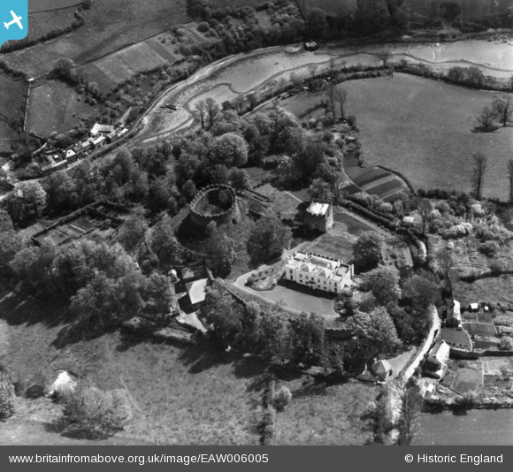
EAW006005 ENGLAND (1947). Trematon Castle, Saltash, 1947. This image has been produced from a print.
© Copyright OpenStreetMap contributors and licensed by the OpenStreetMap Foundation. 2026. Cartography is licensed as CC BY-SA.
Nearby Images (6)
EAW006005

EAW006003

EAW006002

EAW006006

EAW006001

EAW006004

Details
| Title | [EAW006005] Trematon Castle, Saltash, 1947. This image has been produced from a print. |
| Reference | EAW006005 |
| Date | 18-May-1947 |
| Link | |
| Place name | SALTASH |
| Parish | SALTASH |
| District | |
| Country | ENGLAND |
| Easting / Northing | 241060, 57987 |
| Longitude / Latitude | -4.2366673809259, 50.399632412874 |
| National Grid Reference | SX411580 |
Pins
Be the first to add a comment to this image!