
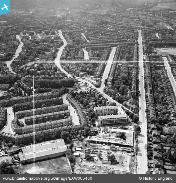
EAW005460 ENGLAND (1947). Tufnell Park Road and construction of Hollins House and McCall House, Tufnell Park, 1947. This image was marked by Aerofilms Ltd for photo editing.
© Copyright OpenStreetMap contributors and licensed by the OpenStreetMap Foundation. 2026. Cartography is licensed as CC BY-SA.
Nearby Images (9)
EAW005460

EAW005466

EAW005455

EAW005459

EAW005461

EAW005465

EAW005458

EAW005467

EAW005456

Details
| Title | [EAW005460] Tufnell Park Road and construction of Hollins House and McCall House, Tufnell Park, 1947. This image was marked by Aerofilms Ltd for photo editing. |
| Reference | EAW005460 |
| Date | May-1947 |
| Link | |
| Place name | TUFNELL PARK |
| Parish | |
| District | |
| Country | ENGLAND |
| Easting / Northing | 529967, 185865 |
| Longitude / Latitude | -0.12505813483098, 51.556200181005 |
| National Grid Reference | TQ300859 |
