
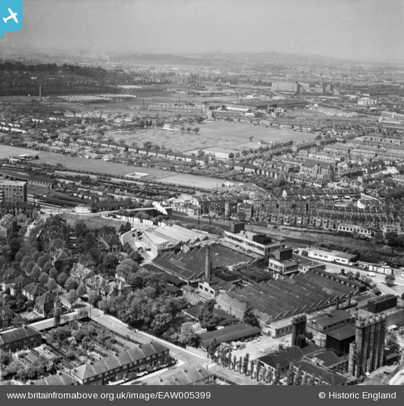
EAW005399 ENGLAND (1947). Wall's Ice Cream and Sausage Factory and the North Acton Playing Fields, Acton, from the south-east, 1947
© Copyright OpenStreetMap contributors and licensed by the OpenStreetMap Foundation. 2026. Cartography is licensed as CC BY-SA.
Nearby Images (30)
EAW005399

EPW037285

EAW006455

EAW006448

EAW006454

EAW005406

EAW005396

EAW005397

EAW005403

EAW006452

EAW006447

EAW006449

EAW006453

EAW005398

EAW005395

EPW037287

EAW005400

EAW006446

EAW005401

EPW037291

EPW037284

EAW005405

EPW037289

EAW006451

EPW037288

EPW037290

EAW005402

EPW037286

EAW006450

EAW005404

Details
| Title | [EAW005399] Wall's Ice Cream and Sausage Factory and the North Acton Playing Fields, Acton, from the south-east, 1947 |
| Reference | EAW005399 |
| Date | 17-May-1947 |
| Link | |
| Place name | ACTON |
| Parish | |
| District | |
| Country | ENGLAND |
| Easting / Northing | 520547, 181166 |
| Longitude / Latitude | -0.26249321458326, 51.516056248836 |
| National Grid Reference | TQ205812 |
Pins

Matt Aldred edob.mattaldred.com |
Thursday 7th of March 2024 03:27:20 PM | |

Sparky |
Monday 7th of August 2017 08:28:39 AM | |

s1mple |
Wednesday 17th of June 2015 09:29:49 AM | |
|
s1mple |
Sunday 29th of December 2013 04:24:49 PM | |
|
s1mple |
Sunday 29th of December 2013 04:22:06 PM | |
|
s1mple |
Sunday 29th of December 2013 04:21:19 PM |