
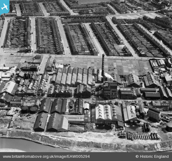
EAW005294 ENGLAND (1947). Howards and Sons Uphall Chemical Works and adjacent residential streets, Loxford, 1947
© Copyright OpenStreetMap contributors and licensed by the OpenStreetMap Foundation. 2026. Cartography is licensed as CC BY-SA.
Nearby Images (17)
EAW005294

EAW005295

EPW046636

EAW005296

EPW046632

EPW046638

EAW005297

EPW046633

EPW046637

EPW046635

EAW005292

EPW046631

EAW005293

EAW005298

EPW046639

EPW046634

EAW005291

Details
| Title | [EAW005294] Howards and Sons Uphall Chemical Works and adjacent residential streets, Loxford, 1947 |
| Reference | EAW005294 |
| Date | 29-April-1947 |
| Link | |
| Place name | LOXFORD |
| Parish | |
| District | |
| Country | ENGLAND |
| Easting / Northing | 543757, 184998 |
| Longitude / Latitude | 0.073392573046942, 51.545062830118 |
| National Grid Reference | TQ438850 |
Pins
Be the first to add a comment to this image!