
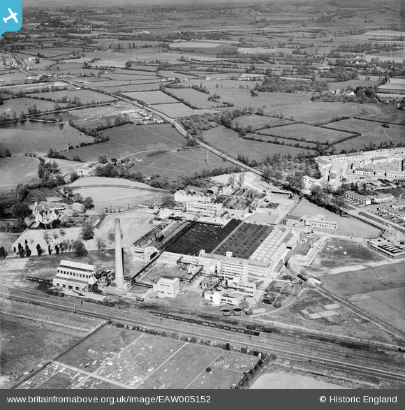
EAW005152 ENGLAND (1947). The British Cellophane Ltd Factory and the surrounding countryside, Bridgwater, 1947
© Copyright OpenStreetMap contributors and licensed by the OpenStreetMap Foundation. 2026. Cartography is licensed as CC BY-SA.
Nearby Images (21)
EAW005152

EAW005147

EAW051133

EAW005146

EAW005154

EAW005143

EAW051131

EAW005142

EAW051129

EAW005155

EAW005156

EAW005149

EAW005158

EAW005151

EAW051130

EAW051134

EAW005150

EAW005157

EAW051128

EAW005145

EAW051127

Details
| Title | [EAW005152] The British Cellophane Ltd Factory and the surrounding countryside, Bridgwater, 1947 |
| Reference | EAW005152 |
| Date | 7-September-1947 |
| Link | |
| Place name | BRIDGWATER |
| Parish | BRIDGWATER |
| District | |
| Country | ENGLAND |
| Easting / Northing | 331231, 138276 |
| Longitude / Latitude | -2.9830862496637, 51.139093227626 |
| National Grid Reference | ST312383 |
