
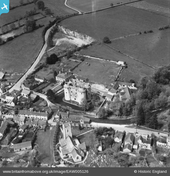
EAW005126 ENGLAND (1947). Nunney Castle, Nunney, 1947. This image has been produced from a print.
© Copyright OpenStreetMap contributors and licensed by the OpenStreetMap Foundation. 2026. Cartography is licensed as CC BY-SA.
Nearby Images (10)
EAW005126

EPW033212

EAW005127

EAW015769

EAW005128

EPW033213

EAW005125

EAW015770

EAW015768

EAW015767

Details
| Title | [EAW005126] Nunney Castle, Nunney, 1947. This image has been produced from a print. |
| Reference | EAW005126 |
| Date | 7-September-1947 |
| Link | |
| Place name | NUNNEY |
| Parish | NUNNEY |
| District | |
| Country | ENGLAND |
| Easting / Northing | 373674, 145740 |
| Longitude / Latitude | -2.3769151755197, 51.209741588439 |
| National Grid Reference | ST737457 |
Pins
Be the first to add a comment to this image!