
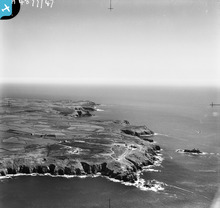
EAW004877 ENGLAND (1947). The coastline from Land's End to Gwennap Head, Land's End, from the north-west, 1947

© Copyright OpenStreetMap contributors and licensed by the OpenStreetMap Foundation. 2026. Cartography is licensed as CC BY-SA.
Nearby Images (7)
EAW004877

EAW033633

EAW004879

EAW033464

EAW020269

EAW033463

EAW020270
 and Armed Knight rocks, Land's End, from the north, 1948. This image has been produced from a damaged negative.")
Details
| Title | [EAW004877] The coastline from Land's End to Gwennap Head, Land's End, from the north-west, 1947 |
| Reference | EAW004877 |
| Date | April-1947 |
| Link | |
| Place name | LAND'S END |
| Parish | SENNEN |
| District | |
| Country | ENGLAND |
| Easting / Northing | 134294, 25292 |
| Longitude / Latitude | -5.7135274706784, 50.067637775163 |
| National Grid Reference | SW343253 |
Pins

Matt Aldred edob.mattaldred.com |
Thursday 11th of March 2021 09:18:32 PM | |
|
Matt Aldred edob.mattaldred.com |
Thursday 11th of March 2021 09:18:13 PM | |

cptpies |
Friday 6th of December 2013 11:33:48 AM |
User Comment Contributions
CHL17A Marks Castle. |
cptpies |
Thursday 16th of January 2014 01:10:49 PM |