
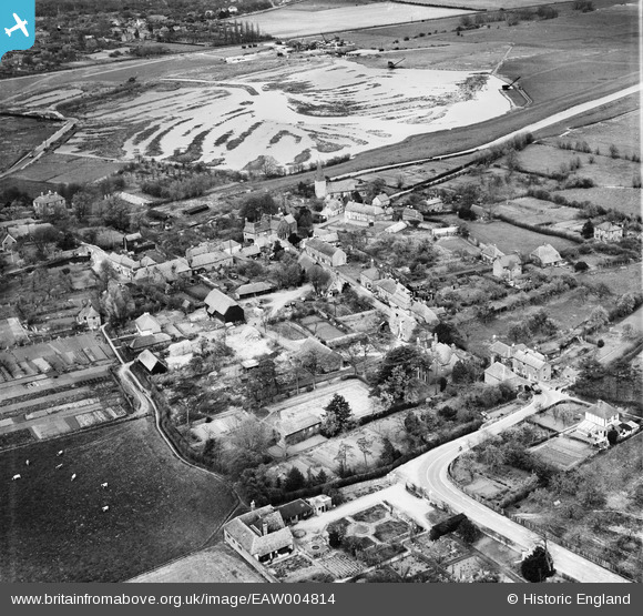
EAW004814 ENGLAND (1947). The town, Fordwich, 1947
© Copyright OpenStreetMap contributors and licensed by the OpenStreetMap Foundation. 2026. Cartography is licensed as CC BY-SA.
Nearby Images (5)
EAW004814

EAW004815

EAW004818

EAW004816

EAW004817

Details
| Title | [EAW004814] The town, Fordwich, 1947 |
| Reference | EAW004814 |
| Date | 25-April-1947 |
| Link | |
| Place name | FORDWICH |
| Parish | FORDWICH |
| District | |
| Country | ENGLAND |
| Easting / Northing | 618032, 159685 |
| Longitude / Latitude | 1.1276538697912, 51.29397364881 |
| National Grid Reference | TR180597 |
Pins

Matt Aldred edob.mattaldred.com |
Saturday 1st of March 2025 10:51:40 PM | |

Al |
Thursday 9th of January 2014 10:23:46 AM | |
|
totoro |
Wednesday 11th of December 2013 11:00:44 PM | |
|
totoro |
Wednesday 11th of December 2013 11:00:19 PM | |
|
totoro |
Wednesday 11th of December 2013 10:54:28 PM |
User Comment Contributions

vertical rail sockets visible in road surface |
Al |
Thursday 9th of January 2014 10:24:18 AM |