
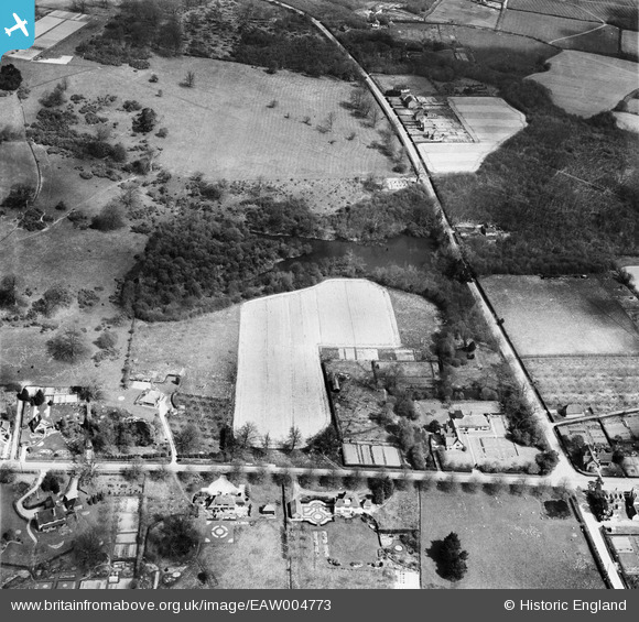
EAW004773 ENGLAND (1947). The B2086 and New Pond Road at The Old Manor House, Benenden, 1947
© Copyright OpenStreetMap contributors and licensed by the OpenStreetMap Foundation. 2026. Cartography is licensed as CC BY-SA.
Nearby Images (6)
EAW004773

EAW004774

EAW004773A

EAW004775

EAW004777

EAW004776

Details
| Title | [EAW004773] The B2086 and New Pond Road at The Old Manor House, Benenden, 1947 |
| Reference | EAW004773 |
| Date | April-1947 |
| Link | |
| Place name | BENENDEN |
| Parish | BENENDEN |
| District | |
| Country | ENGLAND |
| Easting / Northing | 580589, 133287 |
| Longitude / Latitude | 0.57791319091957, 51.069927933316 |
| National Grid Reference | TQ806333 |
Pins
Be the first to add a comment to this image!